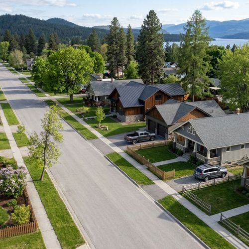
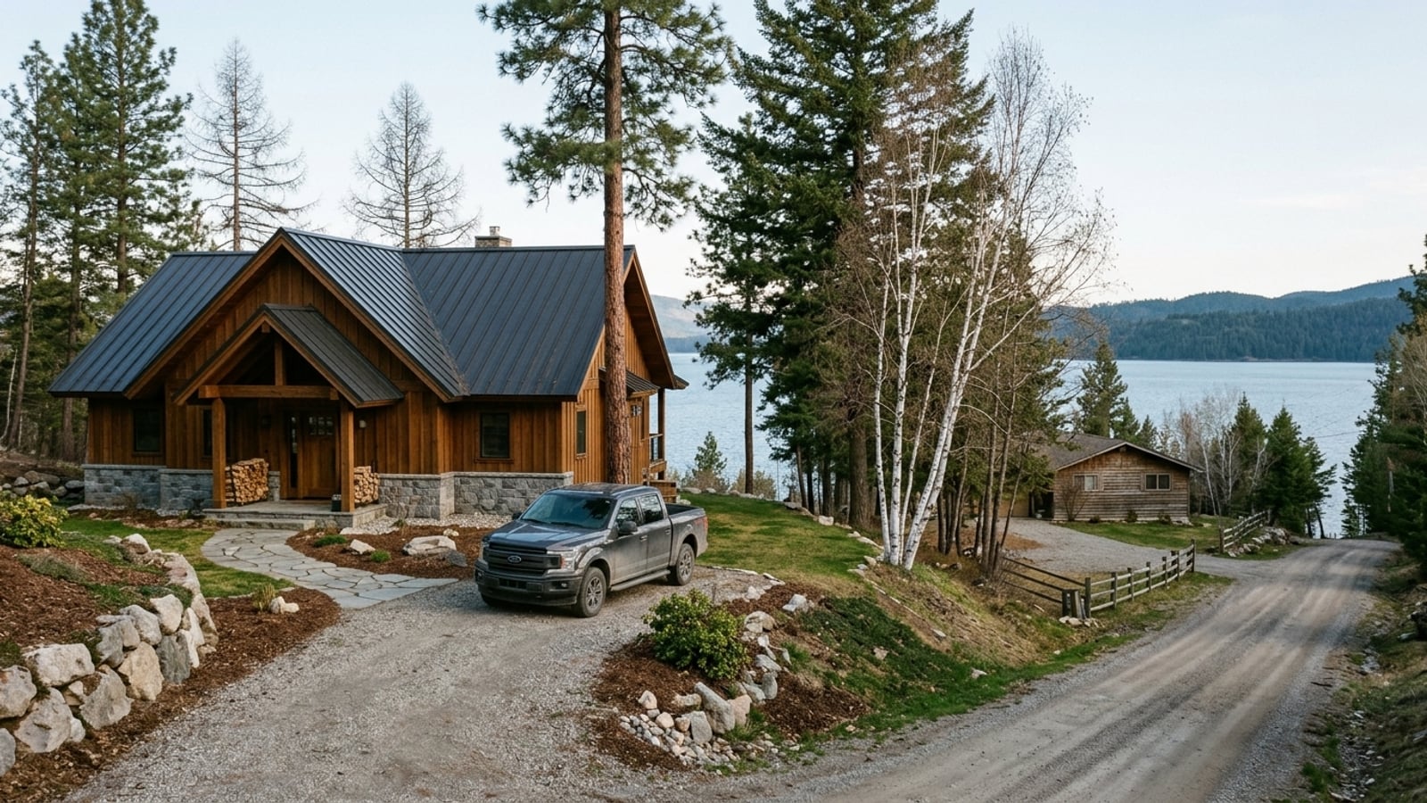
Sagle sits on a peninsula of Lake Pend Oreille, directly south of Sandpoint across the Long Bridge. It's unincorporated and mostly rural, so you're choosing between shoreline properties and timbered acreage, not comparing subdivisions. Your search will organize around roads and bays: parcels with outbuildings along the highway corridors, waterfront homes down winding roads at the lake's edge.
Key Takeaway
If lake access matters most, start your Sagle search with the shoreline areas along Bottle Bay Road and around Garfield Bay and Glengary. If you want acreage and a shorter run to US-95 and the Long Bridge, look along Sagle Road and Dufort Road instead. Either way, you're shopping a market with 8.5 months of supply (single-family, 90 days ending Sept 30, 2026), giving you time to compare areas and room to negotiate.
Who This Guide Is For
You're deciding where on the Sagle side of the Long Bridge to buy a house, and you're weighing lake frontage against land, road access, and the drive into Sandpoint.
Sagle, ID Housing Market: Why Buyers Have Room to Negotiate
Sagle's single-family median sale price jumped 21.3% year over year (based on 27 sales) to $964,757 in the 90 days ending Sept 30, 2026. With so few sales, a few waterfront or acreage closings can move that median. Yet none of those homes sold above list, and the median home took 71 days to sell.
That gives you time to tour more than one area and room to offer below asking. At the 95.2% sale-to-list ratio, a home listed at $1,000,000 would land near $952,000, roughly $48,000 in negotiating room. At the $491 median price per square foot, a 2,000-square-foot house prices near $982,000.
Lakefront Areas in Sagle
These areas offer direct water access on Lake Pend Oreille in exchange for winding roads, shoreline rules and a lake that drops each winter. The market data doesn't break prices down by bay, so pull the last 12 months of sold comps for the road you're considering before pricing a lake house.
Bottle Bay Road
Bottle Bay Road branches east off US-95 near the south end of the Long Bridge. Its lake-facing detached homes sit on varied lot sizes. They are fairly close to the Sandpoint crossing, so the drive to town is shorter than from the southeast bays.
Lake Pend Oreille is drawn down each fall at Albeni Falls Dam, so the summer shoreline and the winter shoreline are different places. A dock floating in July can sit on dry lakebed in winter. Check the winter water depth at the frontage before you price it into your offer.
Garfield Bay and Glengary
Garfield Bay sits on the southeast side of the peninsula, reached by Sagle Road and Garfield Bay Road. Its public boat launch and campground let you live a short drive from the water without paying for your own shoreline. Older cabins mix with newer builds, both lakefront and lake-view.
The launch brings summer boat and trailer traffic. The long, winding road out to US-95 adds time to every Sandpoint trip, particularly in snow.
Rural and Acreage Areas Along US-95
These areas give you land, outbuildings and quicker highway access. In exchange, you give up big-lake frontage, take on private wells, septic systems and often private roads, and live with highway noise closer in. They're listed from closest to the bridge outward, ranging from small rural lots to timbered acreage.
US-95 Corridor South of the Long Bridge
Homes on and just off US-95 have the most direct run north into Sandpoint. The Long Bridge carries US-95 roughly two miles across Lake Pend Oreille, with a separate structure for walking and biking. Housing mixes detached homes on smaller rural lots with larger parcels set slightly back from the highway.
Every trip into Sandpoint funnels onto this single bridge route. Lots near the highway trade quiet for convenience, so visit during commute hours and listen to the traffic from the yard.
Sagle Road Corridor
Sagle Road runs east from US-95 toward Garfield Bay, between the highway and the lake. It's lined with acreage parcels, shops and outbuildings. Under Bonner County zoning, minimum lot sizes range from 5 acres in the R-5 Rural district up to 40 acres in the Forestry district, which dictates what you can build or split.
Bonner County doesn't maintain or plow private roads. On the many private or shared roads here, plowing and repairs fall to neighbors. Ask for the road agreement and find out who handles snow removal before you make an offer.
Dufort Road and Round Lake Area
Detached homes on larger timbered lots line Dufort Road west of US-95. Round Lake State Park sits off Dufort Road, giving this part of Sagle a public lake and trail system without Lake Pend Oreille frontage.
Timbered lots carry wildfire exposure that can affect insurance availability and cost. Get a homeowner's insurance quote early, and check the county wildfire hazard layer for the specific parcel before you go under contract.
Sagle Housing Market at a Glance
Compare these Sagle-wide figures against sold comps for the specific area you're considering.
- Median sale price, single-family homes: $964,757 (90 days ending Sept 30, 2026; based on 27 sales, so treat with caution)
- Change in median sale price vs a year earlier, single-family: +21.3% (90 days ending Sept 30, 2026; based on 27 sales)
- Homes sold, single-family: 27 (90 days ending Sept 30, 2026; the all-homes count is also 27, so every recorded sale was single-family)
- Median days on market, single-family: 71 (90 days ending Sept 30, 2026)
- Sale-to-list ratio, single-family: 95.2% (90 days ending Sept 30, 2026)
- Share of single-family homes sold above list: 0% (90 days ending Sept 30, 2026)
- Months of supply, single-family: 8.5 (90 days ending Sept 30, 2026)
- Homes for sale (inventory), single-family: 74 (90 days ending Sept 30, 2026)
- Median price per square foot, single-family: $491 (90 days ending Sept 30, 2026)
How to Choose a Sagle Area
Start with water access. If you need your own frontage and a dock, look at the Lakefront Areas in Sagle. If a nearby public boat launch is enough, look at Garfield Bay and Glengary or the Dufort Road and Round Lake Area.
Then consider the bridge. If you'll cross the Long Bridge into Sandpoint daily, including in winter, the US-95 Corridor South of the Long Bridge fits best. Occasional trips open up the shoreline and Dufort Road areas.
If you want acreage, a shop or outbuildings and are ready to inspect a well and septic system, look closely at the Sagle Road Corridor and the Dufort Road and Round Lake Area, then review Wells, Septic and Road Access.
Finally, if your budget sits near or below the Sagle median, run the negotiating example in the market section on your own numbers before you set a price ceiling for any area. If you need help sorting through these trade-offs, Jeremy Brown at Northwest Realty Group can pull sold comps for any road named on this page.
Schools, Wells and Shoreline Permits in Sagle
In rural Sagle, you verify property lines and utilities yourself rather than relying on city services. When buying a home in Sagle, build these checks into the contract alongside financing and closing costs. Confirm high-speed internet availability at the exact address with local providers before closing.
School District Lookup
The Lake Pend Oreille School District serves Sagle students. Its Transportation Department page covers attendance zones but offers no searchable address lookup, and boundaries can change. Confirm the specific property's school assignment directly with the district rather than assuming it from the neighborhood.
Wells, Septic and Road Access
Most Sagle acreage relies on private wells and septic systems. The Panhandle Health District issues all septic permits for Bonner County, and every subsurface sewage disposal system requires one. Request well logs, a flow test, a water-quality test and septic permit records from the seller.
A failed septic system or a low-yield well can cost far more than any discount negotiated on price. Make both well and septic inspections contingencies in your contract.
Docks and Shoreline Permits
Docks and other structures on Lake Pend Oreille need an encroachment permit from the Idaho Department of Lands. For a single-family dock, the state notifies adjacent waterfront owners unless the applicant supplies their consent, and those owners have 10 days to object. Also look up the address on the FEMA Flood Map Service Center.
An unpermitted dock may have to be permitted or removed after closing. Ask the seller for the encroachment permit number before you rely on the dock's value in your offer.
Sagle, ID Neighborhoods FAQs
What Is Sagle, Idaho Like?
Sagle is a census-designated place rather than an incorporated city, with a mostly detached, rural and lakefront housing market. The U.S. Census Bureau publishes its population data.
What Are the Downsides of Living in Sagle?
The main downsides are private well, septic and road upkeep, a single commute route over the Long Bridge, and a lake drawn down by mid-November. There's also wildfire exposure: the Bonner County Community Wildfire Protection Plan treats almost the entire county as Wildland Urban Interface.
What County Is Sagle, Idaho In?
Sagle is in Bonner County, not Kootenai County. Building, zoning and septic permits run through Bonner County and the Panhandle Health District rather than a city government.
How Far Is Sagle From Sandpoint?
Sagle sits directly south of Sandpoint, connected by US-95 and the Long Bridge. Map the drive from your specific address, since shoreline areas such as Garfield Bay add significant time.
How Far Is Sagle From Spokane and Coeur d'Alene?
Sagle is north of Coeur d'Alene via US-95 and northeast of Spokane via US-95 and I-90. Map your specific address to confirm exact distances and times.
Is Sagle, Idaho Safe?
The Bonner County Sheriff's Office handles law enforcement in unincorporated Sagle, and you can request incident records from the sheriff. Agency-level crime data for the county is on the FBI Crime Data Explorer.
What Is the Zip Code for Sagle, Idaho?
The primary zip code is 83860. Nearby communities such as Cocolalla use their own zip codes, so confirm a listing's community and zip code with county records before making an offer.
What Growing Zone Is Sagle, Idaho In?
The 83860 zip code is primarily in USDA Plant Hardiness Zone 6b, though shoreline and higher-elevation parcels can have different microclimates. Check a property's zone on the official USDA Plant Hardiness Zone Map.
Sources
- Redfin: Data Center
- U.S. Army Corps of Engineers: Albeni Falls Dam
- The Spokesman-Review: Long Bridge
- Bonner County Parks: Garfield Bay
- Wikipedia: Round Lake State Park
- Bonner County: Zoning Code
- Bonner County: Road Maintenance
- Bonner County: Wildfire Protection Plan
- Bonner County: Septic Permit Information
- Idaho Legislature: Lake Protection Act
- Lake Pend Oreille School District: Transportation
- Wikipedia: Sagle, Idaho
- Plantmaps: 83860 Hardiness Zone
Check out this article next